TCD Website Brings 17th-Century Maps Together for First Time in 300 Years
Posted on: 13 May 2013
A new Trinity College website brings a unique 17th-century map collection together for the first time in 300 years as a public online resource.
The Down Survey website (http://downsurvey.tcd.ie) maps out for the first time in great detail the dramatic transfer in land ownership from Catholics to Protestants and changes our understanding of 17th-century Ireland.
The Down Survey of Ireland, undertaken by the Cromwellian regime in the years 1656-1658, introduced modern mapping techniques into Ireland creating the first recognizable maps of the country. It also was the first ever detailed land survey on a national scale anywhere in the world and measured all the estates to be forfeited by Catholic landowners.
This magnificent map collection, the originals of which were destroyed in two fires in 1711 and at the Four Courts in 1922, comprises county, barony and parish maps and is rich in detail showing not only townland boundaries but also churches, roads, rivers, bogs, woods and settlements.
Led by Dr Micheál Ó Siochrú, Associate Professor in Modern History, Trinity historians have now tracked down over 2,000 contemporaneous copies of the original survey maps in dozens of libraries and archives throughout Ireland, Britain and France, and brought them together as a free online resource.
By overlaying these maps onto Ordnance Survey maps and Google maps, and employing GIS technology, the website allows users to explore this turbulent period in Irish history to an extraordinary level of detail.
Key features of the website include:
- 2,000 magnificent county, barony and parish maps from the Down Survey
- National, provincial and county maps detailing massive land ownership transfer
- Mapping out of murders and violent assaults reported during the 1641 rebellion
- Representation of 17th-century road network
- Searchable database of over 10,000 landowners
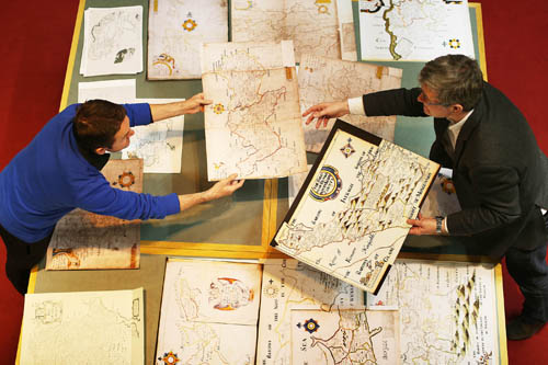
Dr Seamus Lawless and Dr Micheál Ó Siochrú view maps from the Down Survey of Ireland in the Glucksman Maps Library
Speaking at the launch, Dr Micheál Ó Siochrú said: “The Down Survey website is an extraordinary and unique resource for early modern Irish history, which will absolutely transform our understanding of 17th century Ireland. Preliminary research based on on-going work suggests that our understanding of the scale and timing of the massive transfer of land from Catholic to Protestant landholders will need to be reassessed.”
“The bringing together of this highly detailed map collection and related contemporaneous material with the aid of GIS technology allows us to reconstruct this period of Irish history. It will be of great interest to historians, genealogists, sociologists, engineers and anyone with an interest in Ireland, its past and its people.”
The new website was introduced by UCC Professor William J Smyth, co-editor of the Atlas of the Great Irish Famine, and by Ed Parsons, Chief Geospatial Technologist at Google.
Media Coverage:
- RTE Radio 1, Morning Ireland, Monday, May 13, 2013
- RTE 1, Six One News, Monday May 13, 2013
- RTE 1, Nuacht, Monday, May 13, 2013
- TG4, Nuacht, Monday, May 13, 2013
- Irish Times, Saturday, May 11, 2013, Trinity’s online Down Survey gives new life to long-gone Ireland
- Sunday Independent, Sunday, May 12, 2013, Maps reveal owners of land taken by Cromwell
- Irish Times, Tuesday, May 14, Map shows change in 17C landownership
- Irish Examiner,Tuesday, May 14, 2013,
- Irish Independent, Tuesday, May 14, Digital record of land plundered by Cromwell goes live