Current Projects
CoastSnap Dublin Bay
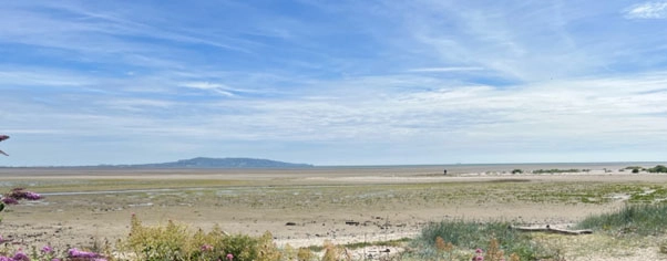
CoastSnap is a global citizen science project that turns mobile phones into a coastal monitoring tool. Three stations will be deployed across the Dublin Bay UNESCO Biosphere Reserve: (1) the north end of Dollymount Strand on North Bull Island in north Dublin Bay to measure beach and dune erosion, (2) the south end of Dollymount strand to measure beach and dune accretion, and (3) the Merrion Gates entrance to Booterstown spit in south Dublin Bay to monitor the expansion of a young (< 30 year old) sand spit/dune/lagoon complex, along with recording seasonality in salt marsh plant cover, bird species presence/absence, and environmental processes such as algae blooms.
Visitors to those locations place their mobile phone in the station holder, snap a picture, and upload it via a QR code. Every snap will become part of a community database, building a long-term dataset of how our coastal environments are changing over time. Visitors can also download the CoastSnap app for free from their app store.
CoastSnap Dublin Bay is funded by the Trinity Civic Engagement for Societal Impact Award. The project is further supported by Trinity’s School of Natural Sciences and School of Engineering, Dublin City Council, National Parks and Wildlife Service, Dublin Bay UNESCO Biosphere Partnership, and the EU-funded REWRITE project (under grant agreement 101081357).
Assessment of Irish Saltmarshes
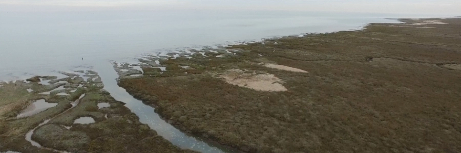
Our research group aims to advance our understanding of Irish salt marshes (in terms of geomorphology, composition and ecosystem service provision) to complement the already large body of knowledge in northwest European countries (e.g. the UK, the Netherlands, Belgium, Germany). We aim to inform coastal management in Ireland and facilitate a shift away from ‘hard’ engineering towards more nature-based coastal solutions (particularly for flood risk management). An improved understanding of the variation in composition and morphology of Irish marshes and the hydrodynamic settings within which they flourish is key if we want to successfully implement nature-based coastal solutions to the hazards posed by climate change.
We focus primarily on the links between marsh morphology, substrate composition and hydrodynamic forcing. We regularly measure key parameters of marsh composition (e.g. vegetation type, substrate organic content and particle size), marsh elevation and slope, and monitor inundation frequency and wave characteristics near marsh edges at a number of Irish salt marshes.
NATURESCAPES
Nature-based Solutions (NBS) are increasingly recognised as crucial in addressing the interrelated challenges of climate change, biodiversity loss and social injustice. Despite this, we lack an understanding of the synergies and trade-offs that multiple NBS offer and of who benefits under which conditions. Moreover, the challenge of implementing NBS remains significant, and a greater understanding of the best methods of NBS implementation is needed to achieve inclusive, sustainable development.
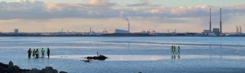
The NATURESCAPES project, funded by an EU Horizon grant, will investigate the above challenges in various case study regions across the global North and South. The project kicked off in November 2023 and will run over four years, involving the collaboration of researchers from several universities and NGOs. The team at Trinity College will contribute to the NATURESCAPES project by mapping and assessing existing NBS in the Dublin Bay area and determining the benefits that NBS in different configurations generate for climate, biodiversity, and communities with the help of citizen science.
REWRITE
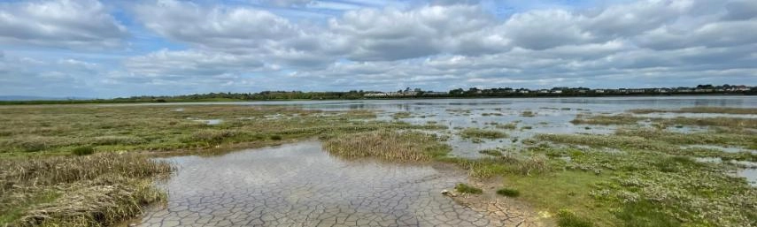
Within European coastal zones, intertidal areas consisting of soft sediment emerging during each low tide form complex seascapes covering over 10,000 km² along the 35,000 km of tidal coastline. These habitats provide vital ecosystem services and have the potential to address the biodiversity-climate crisis by contributing to carbon neutrality, climate resilience and biodiversity support. However, these seascapes are disappearing, fragmented, and polluted, leading to a decline in their provision of goods and services.
Rewilding, the process of restoring and preserving natural ecosystems by allowing them to regenerate independently with minimal human interference, is primarily recognised as one of the most promising NBS for fostering ecosystem services, biodiversity, and sustainability. The REWRITE project, funded by an EU Horizon grant, aims to rewild European shores, ensuring climate resilience, biodiversity support, and societal benefits for the future. The project commenced in October 2023 and will run over five years with input from 25 partners from 11 European states, the UK, Canada, and the USA, bringing together an interdisciplinary consortium of natural and coastal environment and social sciences and humanities experts. Trinity College will contribute to the REWRITE project by investigating the ecological and social functioning of intertidal seascapes within Dublin Bay and assessing how factors such as CO2 increase, temperature rise, sea level rise, extreme events, and biodiversity loss impact these seascapes at local and global scales.
To read more about the REWRITE project, visit the webpage here.
Emergence, Resilience, and Vulnerability of Booterstown Spit as Urban Coastal Infrastructure
Erica Terese Krueger
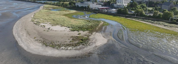
Booterstown Spit (south Dublin Bay, Ireland) has emerged over the past 25 years as a dynamic coastal landform of increasing environmental and societal importance within a highly urbanised setting. Using aerial imagery, topographic surveys, sediment analysis, hydrodynamic data, and water quality monitoring, these studies document the spit’s evolution from a small sand bar in the late 1990s into a recurved vegetated spit by 2025. Growth is primarily driven by northward longshore sediment transport under southeasterly wave forcing, while vegetation colonisation promotes dune stability and the development of salt marsh, lagoon, and seagrass habitats. Together, these interconnected systems function as a nature-based solution that dissipates wave energy, stores sediment, enhances biodiversity, and protects critical urban infrastructure in south Dublin Bay. Storm monitoring between 2024 and 2026 demonstrates both resilience and vulnerability within the system. Repeated overwash events and storm clustering expanded washover fans, limited vegetation recovery, and increased susceptibility to breaching, highlighting the importance of cumulative storm impacts in shaping long-term coastal change. Water quality analysis further identified elevated nutrient concentrations in nearby stream outflows, raising concerns for the health and stability of pioneer salt marsh vegetation. The findings emphasise the need for long-term, high-resolution monitoring and adaptive coastal management that recognises Booterstown Spit as living infrastructure. Future research will focus on nutrient dynamics, vegetation resilience, sediment transport pathways, and citizen science monitoring initiatives such as CoastSnap Dublin Bay to support climate adaptation planning and coastal resilience in Dublin Bay.
Response of an Anthropogenically Initiated Urban Barrier Island to Past and Future Environmental Change
Abbie Nugent
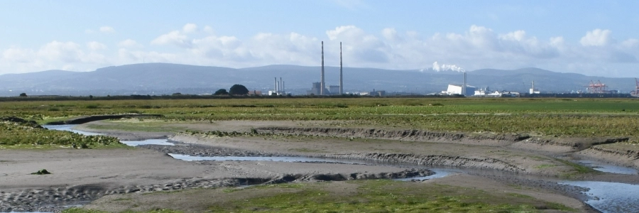
Large-scale sedimentary features, such as barrier islands, may act to protect urban coasts from climate change impacts. An adequate understanding of, and ability to predict, geomorphological processes that govern the long-term natural and/or human induced changes of such landforms in a highly managed context is thus essential to the successful mitigation of future urban coastal flood risk. This project will contribute to a better understanding of how the semi-natural North Bull Island offshore of Dublin, Ireland, has been responding to physical drivers, both ‘natural’ (waves, tides, climate), and human (management intervention and human use) drivers over the past decades.
Such knowledge is key to exploring how the island may respond to a range of future climate and human intervention scenarios and how such change may alter the delivery of ecosystem services presently derived from the beach, dune, salt marsh and intertidal habitats present on the island. In a larger, global context, this case study will allow lessons to be learnt for the potential future, context-dependent incorporation of dynamic coastal depositional features as elements of urban coastal climate change adaptation.
Comparison of Natural and Managed Coastal Wetland Restoration
Juliet Rounce
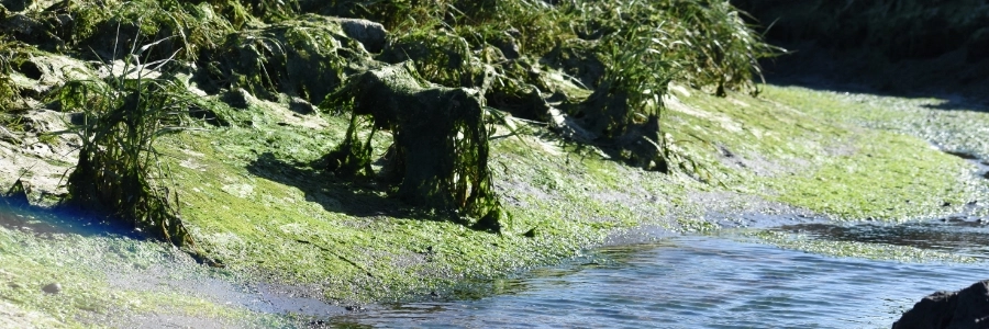
Restoration of coastal wetlands occurs naturally (e.g., via breaching) or through planned management schemes. Such restoration plans should be underpinned by consideration of ecosystem services, including flood defence, increased biodiversity, community health benefits and carbon sequestration. Broadly, due to greater rates of carbon burial and lower mineralisation compared with terrestrial environments, coastal wetlands are commonly considered as carbon sinks. Saltmarsh sediments accumulate carbon, the rate of which is regulated by relative sea level rise. It is therefore important to understand how present functioning will alter through time and under changing hydrodynamic forcing.
Monitoring of restoration sites commonly focuses on ecology, therefore, this project will look at the hydrogeomorphological aspect, with the aim to assess site suitability for restoration and understand the response of restoration sites to future climate scenarios. Comparing natural and managed sites, this project will assess the interaction and variation of biophysical and hydrological processes, such as current carbon stocks and plant productivity, utilising field monitoring of water levels, waves and sediment transport, alongside ecological surveys.
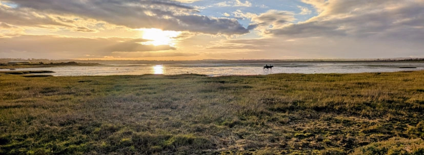
Seagrass-Saltmarsh Connectivity within an Irish Coastal Seascape
Kevin O’Leary
Intertidal seagrass beds and saltmarsh ecosystems represent some of Ireland’s most valuable natural ecosystems, due to their roles in coastal defence, food provision for fisheries, and carbon sequestration. They also provide habitat for many of Ireland’s protected species, including migratory bird species. While both environments are found in the intertidal zone, little is known of the interactions and exchanges between these systems, and how they may influence the functions and resilience of these environments when they exist concurrently.
This project aims to identify and quantify the interactions between seagrass and saltmarsh systems to further our understanding of their joint development and response to changing environmental drivers, supporting a management approach which considers intertidal seagrass-saltmarsh systems as a connected seascape. Through literature and archival review, and a field study at the Malahide Estuary, Dublin, this project will look at the ecological and hydrodynamic exchanges between these systems, as well as their joint response to external hydrometeorological drivers.
This project is funded by a Trinity Doctoral Research Award, and supported by the National Parks and Wildlife Service, REWRITE and the British Society for Geomorphology.
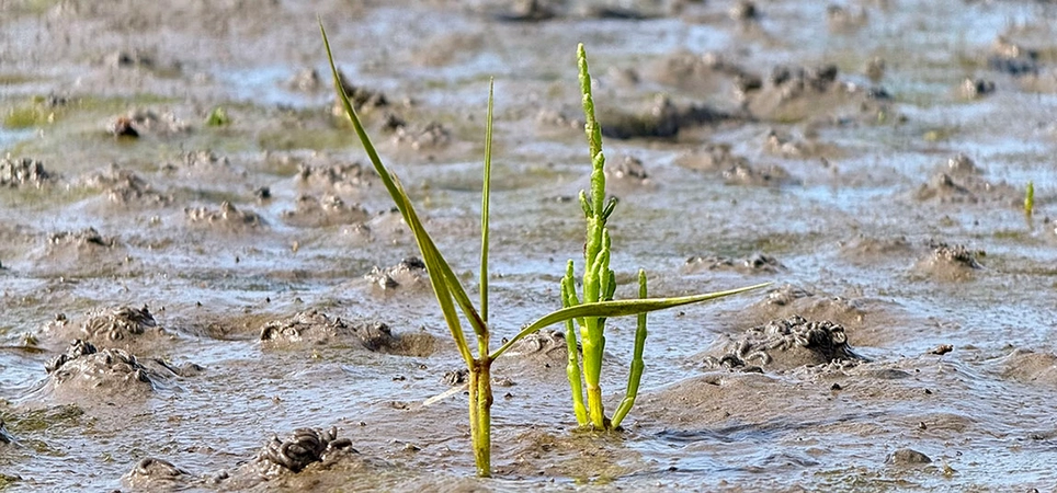
Beyond Windows of Opportunity: The Germination and Establishment of Two Salt Marsh Pioneers in a Changing Climate
Jenny Clarke
Salt marshes are intertidal ecosystems characterised by the presence of halophytic (salt-tolerant) plants. These ecosystems provide valuable services such as coastal protection, carbon sequestration, habitat provision, and biodiversity support. Their ability to provide these services, however, is increasingly threatened by the effects of climate change on vegetation and, consequently, on salt marsh formation and functioning.
The lateral expansion of salt marsh ecosystems — and, therefore, their persistence — depends on the successful establishment of pioneer species on the adjacent bare tidal flats in the 'pioneer zone'. It has been suggested that periods of reduced physical forcing below a critical disturbance threshold, known as 'windows of opportunity' (WoOs), are essential for seedling establishment here. With climate change driving increasingly unpredictable weather events, however, there is concern that WoOs for pioneer establishment may decrease in both frequency and duration. Understanding how altered climatic conditions influence the growth and biophysical traits of pioneer species is thus essential for predicting the resilience of salt marshes.
This PhD explores how increased atmospheric CO₂ concentrations may influence the germination, establishment, and biophysical properties of two key salt marsh pioneers, Spartina anglica and Salicornia europaea. Seedlings grown in laboratory mesocosms under both ambient and raised-CO₂ conditions will be assessed with respect to these characteristics and compared to seedlings growing naturally at North Bull Island, Dublin Bay. This PhD will (1) bridge knowledge gaps between short-term seedling establishment dynamics and long-term geomorphological change of salt marshes, (2) contribute to broader discussions on the resilience and adaptive capacity of Irish salt marshes in response to a changing climate, and (3) inform nature-based coastal protection strategies by identifying conditions that support natural salt marsh development and persistence.
This project is funded by Research Ireland (Taighde Éireann) and the Environmental Protection Agency (EPA) Government of Ireland Postgraduate Scholarship.
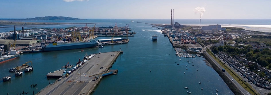
Environmental and Geomorphological Evolution of the Dublin Docklands: Implications for Climate Change Adaptation
Charlotte Fox
The Dublin Docklands occupy a former estuarine landscape that has undergone profound transformation through centuries of land reclamation, dredging, industrialisation, and urban development. These changes have fundamentally altered the area's geomorphology, hydrology and ecology, while also influencing its vulnerability to sea-level rise, coastal flooding, and storm surges. Despite their importance, the long-term environmental consequences of this transformation remain poorly understood.
This project aims to reconstruct the environmental and geomorphological evolution of the Dublin Docklands from the pre-industrial period to the present day, before investigating how centuries of landscape change have altered coastal processes and influenced the area's resilience to future sea-level rise. Historical maps, hydrographic charts, aerial imagery, LiDAR data, GIS analysis, and field samples will be combined to reconstruct changes in the shoreline, estuary and reclaimed land through time. Numerical modelling will then be used to explore how these historical changes continue to influence present-day coastal processes and how the Docklands may respond to the impacts of climate change, including sea-level rise and coastal flooding.
This project is supported by a Trinity Research Doctorate Award.
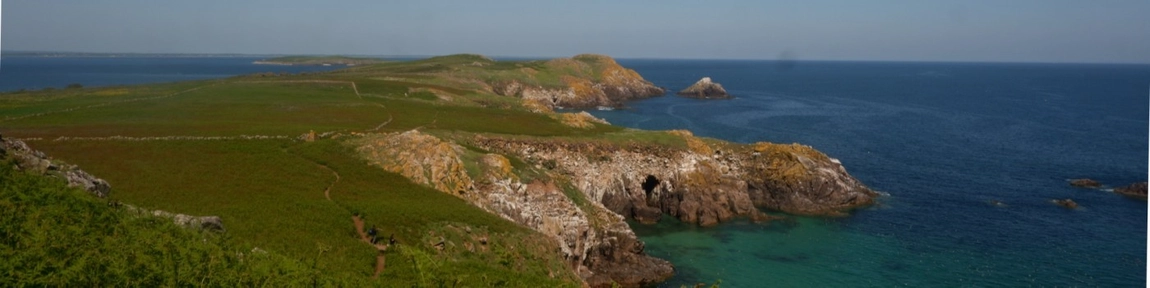
AI and Machine Learning for Assessing Coastal Vulnerability to Climate Change
Ciara Bartley
Climate change and its effect are ever present and ever growing globally. Projected increases in the frequency and intensity of climate hazards such as storm surges and sea level rise pose significant risks to Ireland’s communities and environment. Approximately 40% of the Irish population live within 5km of the coast. As well as that, all of Ireland’s major cities and the most densely populated parts of the country are located along the coast. For this reason, coastal erosion poses a huge threat to Ireland. Coastal erosion is driven by sea level rise along with tides, storm surges and waves. Projections indicate an average sea level rise of 0.65m by 2100, further increasing Ireland’s susceptibility to coastal change.
This project focuses on monitoring Ireland's dynamic coastline and investigates how challenges like climate change, sea level rise and storm surges will impact the risk of coastal erosion and flooding over time. This research will utilise machine learning techniques and remote sensing to model Ireland's coastal susceptibility to climate change.
This project is supported by the Co-Centre for Climate + Biodiversity + Water
Life in the Currents
The Life in the Currents (LIC) project represents a novel investigation into the role of naturally driven variability in the historical and contemporary exploitation of marine life in the Northeast Atlantic Ocean. The project will assess the impacts of natural and anthropogenically driven climatic and oceanic variability on marine ecosystems and the effects of these changes on terrestrial life and human societies. The outcome of the project is anticipated to resolve intriguing questions, such as: how do ocean circulations impact primary biological production and coastal geomorphologies; how do oceanic-riverine interactions affect marine ecosystems (e.g., river flooding as a control of terrestrial nutrient run-off into marine ecosystems); to what degree can variable ocean dynamics explain historical variability in fish catch documented for the past 500-hundred years and, how unique are ocean circulation changes within the span of human habitation in Northeast Atlantic?
The LIC project was one of two winners of the Prendergast Challenge-based awards in 2023 and involves a multidisciplinary team of researchers from the Schools of Computer Science and Statistics, Engineering, Geography, History, Mathematics, and Zoology.